

News Highlights
- One map application, available on any device, with over 170 layers to view, combine and analyze.

- Detailed property reports especially useful for land development.
- Save, share and print your map creations.
- Current and historical aerial imagery, viewable from multiple angles.
While Fairfax County has long provided many specific, web-based maps and applications, the release of the new Jade interactive mapping application serves a unique mission as a general map viewer. Jade was designed to provide the public with never-before released map layers, reports, exclusive aerial imagery, and analytical tools to explore County data and business processes.
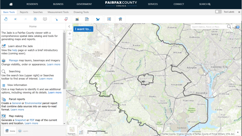
Jade application screenshots. Click to expand.
170 Maps in One
There are over 170 map layers to explore, including property information, land development, public facilities, infrastructure, environmental, and more. Most layers also provide easy access to other County resources such as applications and webpages for more information.
Jade is particularly applicable to those undertaking land development and other engagements with Fairfax County government using custom reports and workflows.
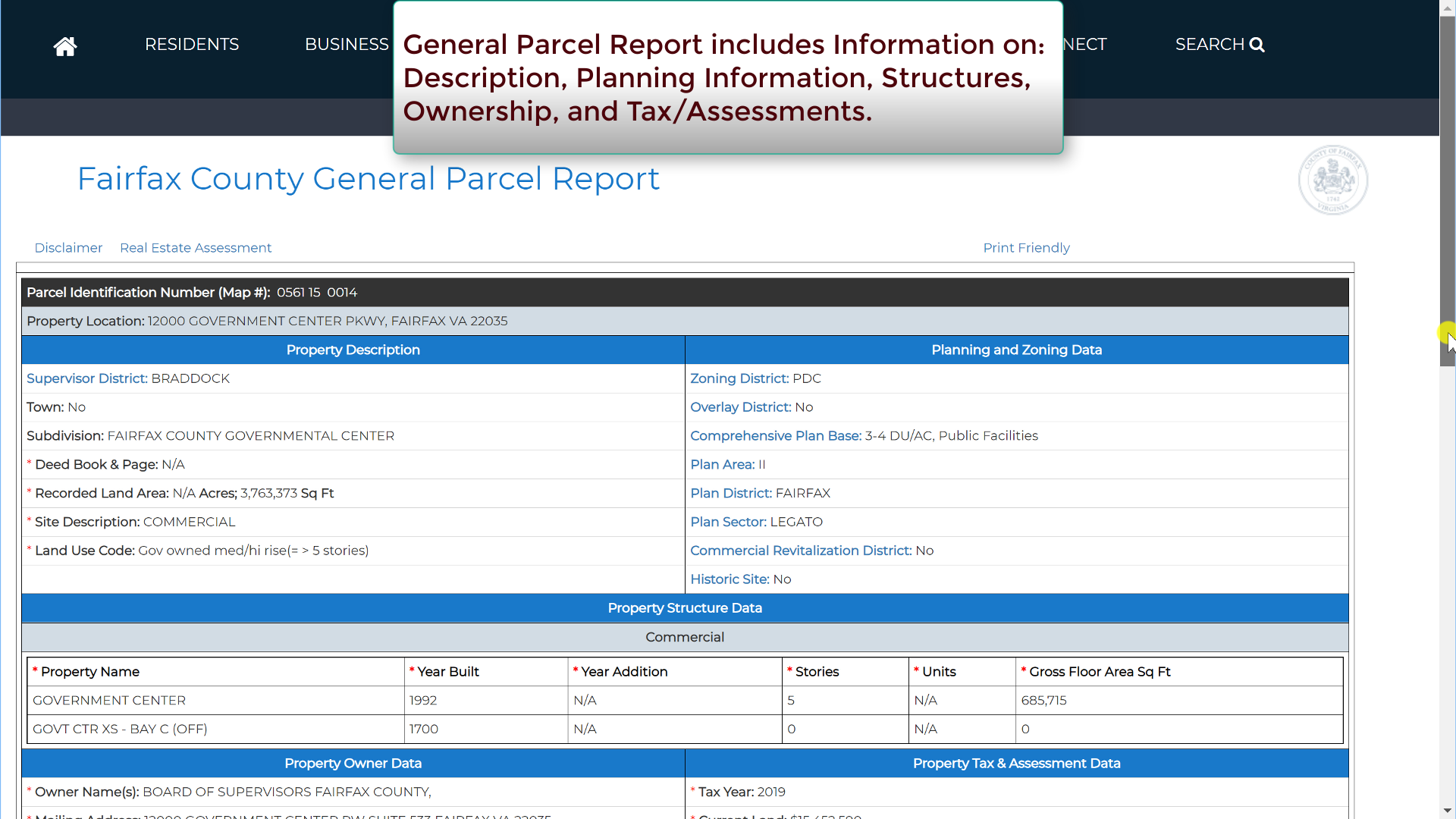
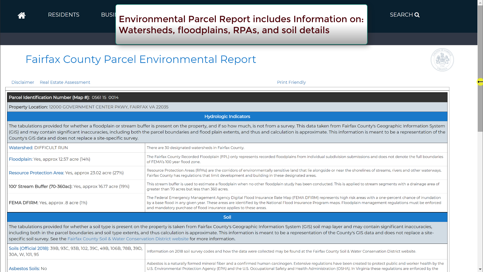
Report, Save and Share
Detailed property reports describing legal and environmental conditions are especially useful for land development activities. To meet this need, Jade users will be able to create reports for every property in Fairfax County:
- A general parcel report uses the most current County data to display information on a property’s description, zoning, structures, ownership, and tax/assessments.
- A separate environmental parcel report includes information on watersheds, floodplains, resource protection areas and soil details.
Users can then capture their efforts in the Jade by exporting created images and maps. They may also share their work via email and social media.
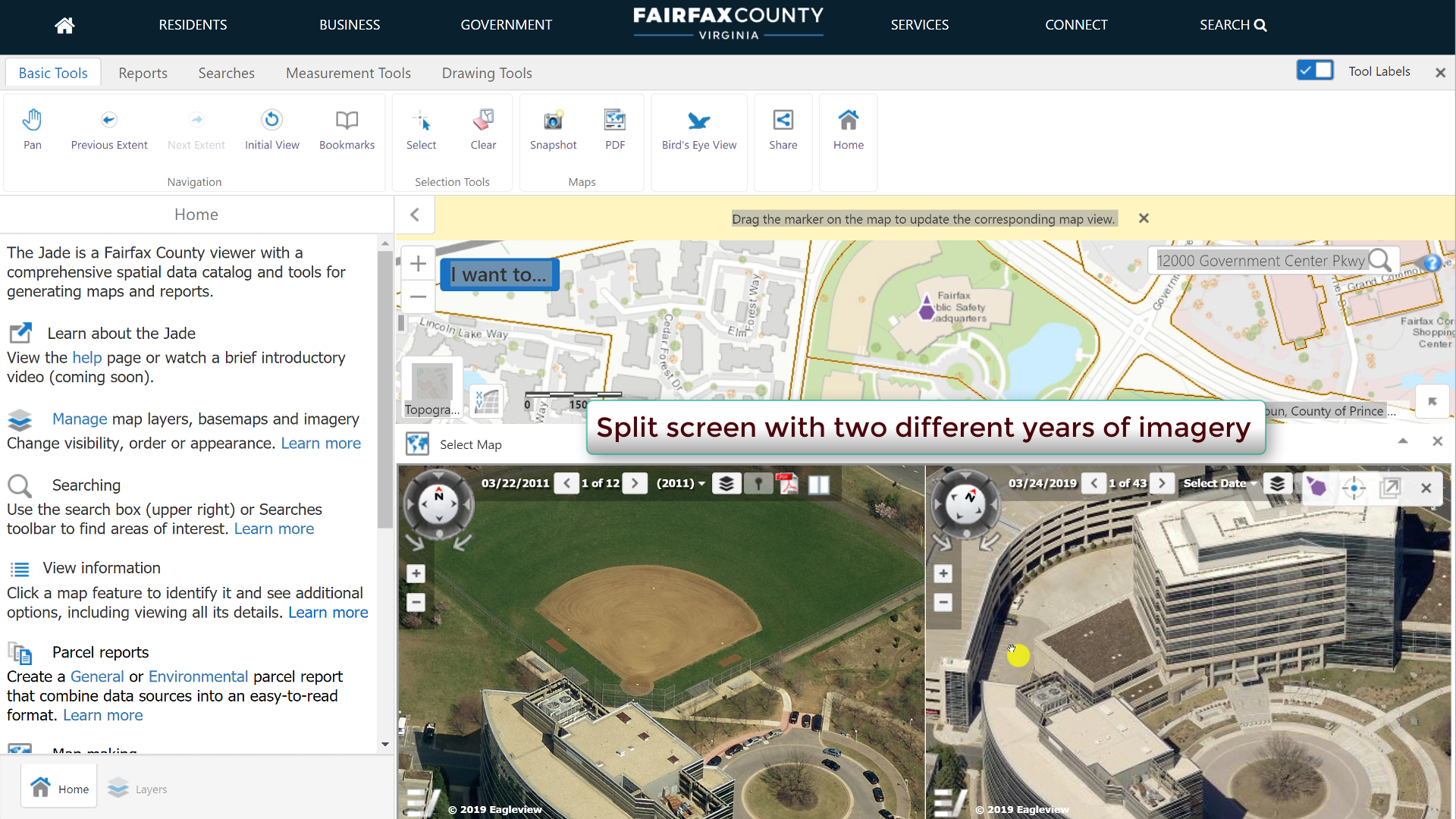
See Fairfax From Different Angles
For the first time, Fairfax County is making its library of oblique aerial imagery available to the public. Users can virtually move around any location in Fairfax County with side-views from each cardinal direction. Furthermore, there are 14 years of aerial imagery, ranging from 1937 to the present.
Businesses, community based organizations and residents often seek information to inform them about demographic and economic changes occurring in Fairfax County. Jade is one of many county efforts to democratize open data through powerful, yet intuitive, interfaces, allowing them to:
- Understand patterns, trends and challenges.
- Evaluate services and programs.
- Obtain customized data for the purposes of business development, policy making, etc.
The Fairfax County interactive mapping gallery offers access to more than 70 available mapping applications. For more information, visit Geographic Information Systems (GIS), a division of the Department of Information Technology.
###
Resources:
![]()