

Transportation Alert:
The Fairfax County Department of Transportation (FCDOT) is conducting an Active Transportation Study of the Route 29 Corridor, extending from I-495 in Fairfax County to Tripps Run at the City of Falls Church/County border, just east of South Maple Avenue. The two-mile corridor is positioned between two major parallel roadways, I-66 to the north and US 50 to the south, which are more geared toward automobiles.
Public Meeting Round 2
Public Meeting Round 1

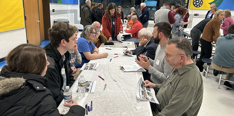
FCDOT held a Public Workshop on Nov. 12, 2025, at Timber Lane Elementary School to share information on existing transportation facilities along the Route 29 corridor, inside the Beltway to the City of Falls Church. The workshop provided residents and commuters to provide feedback on improvements for pedestrians, bicyclists, transit and the street.
Watch: Route 29 Active Transportation Study Presentation English I español
View Slides: Route 29 Active Transportation Study Presentation English I español
Round 1 Community Outreach Survey Summary Available
Thank you to all who participated in the Route 29 Active Transportation Study community workshop and survey, which concluded on Dec. 19, 2025. A summary of results and comments received is now available for review.
Route 29 is a divided highway with at-grade intersections and turn lanes. The roadway itself is often seen as a divide between the north and south sides of the highway because of the difficulty crossing. Crossing at intersections traveling along Route 29 can set up dangerous interactions between cars and pedestrians or bicyclists, and at times, the paths along Route 29 are unpleasant to traverse via walking and biking.
While the current comprehensive plan calls for Route 29 to be expanded from four to six lanes (map), the study aims to conduct a comprehensive review and assessment of the corridor with a focus on providing and enhancing active transportation and transit facilities. The study aims to create an environment that is comfortable for pedestrians and bicyclists, connects both sides of Route 29, improves access to transit, and helps build driver awareness that the corridor is expected to accommodate all users.
In addition, the proximity of Route 29 to the National Capital Trail Network (NCTN) provides an opportunity to help fill active transportation networks in the area, giving users more options to bike, scooter or walk without needing a car. The NCTN currently runs along I-66 with a planned expansion to Route 50, leaving the Route 29 corridor to help provide more connections between the two.
Enhanced transportation facilities for all users should help improve interactions between local businesses, schools, parks, libraries and more for residents.
The study began in July 2025 and is anticipated to be completed by the end of 2026.
Why is this study being conducted?
The study aims to identify opportunities and areas to make Route 29 more comfortable and provide better and more frequent options for people to walk, bike, and use transit along the corridor.
What are the limits of the study?
The study focuses on the segment of Route 29 from the Beltway to Tripps Run (near Maple Avenue) in the City of Falls Church.
How is the corridor being analyzed and what is being measured?
The study will assess pedestrian and bicycle comfort and safety, access for these users, and minimal traffic conditions as needed to support an increase in pedestrian and bicycle improvements along the corridor. It will also explore opportunities to enhance bus rider amenities and accommodations, as well as improve active transportation conditions on the service lanes and at the driveways.
What are the goals of the study?
The study aims to enhance the experience for pedestrians and bicyclists, improve access to transit, and raise driver awareness of the presence of all modes of transportation. The study’s goals include:
How can I provide input on the study?
Who else is involved in the study?
The Fairfax County Department of Transportation (FCDOT) is coordinating with the Virginia Department of Transportation (VDOT), the City of Falls Church and the Providence District Supervisor's Office.
What is VDOT’s role?
VDOT owns the Right-of-Way and operates the traffic signals. FCDOT will coordinate with VDOT for recommendations to ensure feasibility.
What does the Fairfax County Comprehensive Plan say about this corridor?
This section of Route 29 currently has four lanes, with turn lanes at several intersections, and service lanes along parts of the corridor. While the Comprehensive Plan recommends widening Route 29 to six lanes in portions of the corridor, this study seeks to increase multimodal opportunities that will allow the corridor to remain at four travel lanes and identifying ways to improve safety and mobility for all road users.
What are the next steps after the study has been completed?
The study recommendations will guide updates to the Comprehensive Plan, and the County will pursue funding to design the proposed improvements. During the course of the study, the County will seek input from the community on prioritization of the improvements that will assist with implementation and recommendations to
What is the timeline for implementation?
The study will identify both near-term and long-term improvements. Near-term improvements may be implemented within five years depending on feasibility and funding availability, while implementation of larger or more costly improvements is expected to take longer, generally over a 20-25 year timeframe, depending on funding availability.
How are the public meetings promoted or announced to the community?
FCDOT posted the meeting announcement on the study webpage and sent a press release to a wide audience, including media outlets, reporters and public officials. FCDOT also sent a message to Fairfax Alerts subscribers (choose "Public Meetings") and publicized on social media.