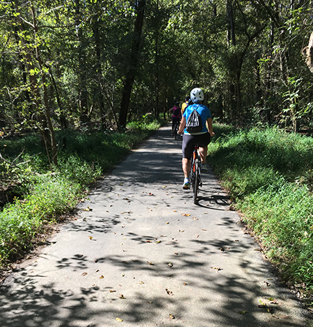
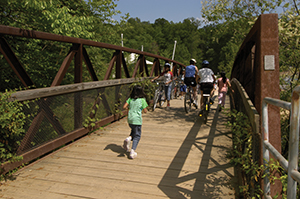
Active Transportation Program

CONTACT INFORMATION: Our office is open 8:00 AM-4:30 PM M-F
703-877-5600 TTY 711
4050 Legato Road, Suite 400
Lauren Delmare
Active Transportation Program Manager

Where to Walk, Hike and Ride in Fairfax County

Biking and walking on the W&OD Trail 
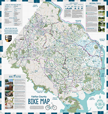
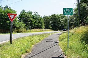
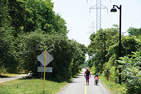
Fairfax County has over 600 miles of walking, hiking and biking trails and paths, including popular regional trails for long distance hiking or biking, and natural surface loop trails for hiking or equestrian use. Use the resources below to learn about what type of active transportation facilities are available in Fairfax County, and find the most enjoyable route to destinations in your neighborhood and beyond.

The following types of facilities are available to help people biking or walking in Fairfax County to get around safely and conveniently.

Bicyclist riding in bike laneSidewalks
A sidewalk is a concrete walkway along the edge of a roadway that is primarily designed for walking, but biking and scooting on sidewalks is legal in Fairfax County unless posted otherwise.

Trails
Trails come in many forms and provide recreation and transportation opportunities for a variety of users. In Fairfax County, primary and secondary trails are wide, paved shared-use paths that run along streets and through parkland. There are also a variety of natural surface trails that are open for hiking, mountain biking and other uses.

Bike Lanes
Bike lanes give people riding bicycles their own space on the road.

Buffered Bike Lanes
Buffered bike lanes use striping to provide additional space between people riding bicycles and vehicular traffic.

Shared Lane Markings
Shared lane markings and “Bikes May Use Full Lane” signage indicate a shared travel lane for bicycles and cars. Motorists may legally cross the double yellow line in order to safely pass a person riding a bicycle, as long as the oncoming lane is clear.

Bicycle Wayfinding Signs
Bicycle wayfinding signs are placed to help direct cyclists towards preferred bicycle routes, and provide information like destinations, directional arrows, and distance in miles. Look for signs near the Franconia-Springfield, Huntington, Vienna and Wiehle-Reston East Metro stations, in downtown McLean, Tysons along the Washington & Old Dominion (W&OD) Trail and the Fairfax County Parkway Trail.

Bike Lane Brochure


Gerry Connolly Cross County Trail Gerry Connolly Cross County Trail (CCT)
This 40-mile long trail is the primary north/south trail in the Fairfax County, passing through landscapes ranging from remote woods, stream valleys and rolling hills to battlefields and developed parks. The trail varies from wide, paved sections to natural surface sections more appropriate for mountain bikers. The trail crosses many of the county’s main east/west roads. Where space is limited, the trail follows roadside trails or sidewalks. Maps of each section are available online or through the Park Authority’s trails office.
Fairfax County Parkway Trail The Fairfax County Parkway Trail (FCPT)
This 31-mile trail is a flat, well-marked, north/south multi-use trail that runs alongside the Fairfax County Parkway, Burke Centre Parkway, Franconia-Springfield Parkway and Loisdale Road. It stretches from Richmond Highway near Fort Belvoir to Leesburg Pike in Herndon. The FCPT connects with the Washington and Old Dominion (W&OD) Trail just north of the Sunset Hills Road in Reston, the Braddock Road Trail in Lewis Park and the Route 123 Trail near Burke. It overlaps with the Cross County Trail west of the Rolling Road interchange in West Springfield.
east Coast Greenway East Coat Greenway (ECG)
This trail is the nation’s most ambitious long-distance trail. It is a continuous, traffic-free route suitable for bikers of all abilities and ages. From Washington, D.C., the trail enters Fairfax County along the Mount Vernon Trail.
Mount Vernon Trail Mount Vernon Trail (MVT)
This 18-mile paved trail stretches from George Washington’s Mount Vernon Estate to Theodore Roosevelt Island. It connects with several other regional trails, including the Potomac Heritage Trail, Custis Trail, Rock Creek Trail, Four Mile Run Trails and Woodrow Wilson Bridge Trail. The trail is mostly flat and follows a scenic course along the Potomac River. The trail is open for recreation year-round from 6 a.m. to 10 p.m., though commuters may use the trail any time.
W&OD Trail Washington & Old Dominion (W&OD) Railroad Regional Park
This 45-mile paved trail follows the former railbed of the Washington & Old Dominion Railroad, and runs through the Northern Virginia’s urban heartland all the way into the Virginia countryside. W&OD Trail hours are from 5 a.m. to 9 p.m. between Shirlington to the western border of Herndon. Beyond that, the trail closes at dusk.
 

U.S. Bicycle Route 1
The U.S. Bicycle Route System (USBRS) is a developing national network of bicycle routes connecting urban and rural communities via signed roads and trails. U.S. Bicycle Route 1 is a cross-country bicycle route that will run from Florida to Maine. The current alignment of US Bike Route 1 in Virginia follows a similar path as the East Coast Greenway. It is approximately 274 miles long and traverses 21 Virginia localities, including 14 counties, three independent cities, and four incorporated towns.

  Potomac Heritage National Scenic Trail
Linking the tidal Potomac and upper Youghiogheny river basins, the evolving Potomac Heritage National Scenic Trail network lies within a corridor rich in historic pathways and waterways. You can travel this historic corridor today—on foot, bicycle, horse or by boat — exploring contrasting landscapes between the Chesapeake Bay and the Allegheny Plateau.


Bike Your Park Day Lake AccotinkLake Accotink
The trail system at Lake Accotink (pictured) is perfect for a quick ride, or as a way to add miles to a day trip on the Cross-County Trail. A loop that goes around Lake Accotink provides scenic views of the lake and is appropriate for beginning riders. The adjacent singletrack is tight and twisty, with roots and some steep climbs. The park also has boat rentals and picnic areas.

Fountainhead
Fountainhead Regional Park is a challenging mountain biking destination trail in Fairfax County that uses color designations to indicate the level of difficulty. The Green loop includes rooty flow trails, bridges and 12-inch drops. The Blue loop includes rooty flow trails, bridges, drops and wooden technical trail features. The Black loop adds advanced, expert-only rock features in tight twisty terrain with 4-foot drops. Please respect the trails by riding the tread or walking if uncomfortable with the terrain.

Bull Run Occoquan Trail
Enjoy great views on this point-to-point trail along the Occoquan Reservoir. The 6-mile long trail starts in Fountainhead Regional Park and goes to the Bull Run Marina parking lot. This very technical trail has short, steep climbs/descents, as well as exposed roots and rocks. Follow the blue blazes, and yield to hikers and horses at all times.

Lake Fairfax
At 480 acres, Lake Fairfax Park hosts a full range of amenities, including a skatepark that is open to bicycles, a pump track suitable for bicyclists of all ages and abilities, a lake and streams for paddling or fishing, a water park, campgrounds, pavilions, athletic fields and nearly 10 miles of natural surface trails. The trails are rooty and fast with a deceiving amount of elevation change. The system includes a flow trail that is fast and fun for everyone from beginner to expert riders.

Laurel Hill
Located on the grounds of the former Lorton Prison, Laurel Hill is a fun trail system perfect for beginners. With trails ranging from flowing singletrack to doubletrack, Laurel Hill is a great place to go for a quick ride or to start a day trip on the Cross-County Trail, which starts at Laurel Hill and goes north all the way to Great Falls Park. The trails at Laurel Hill tend to drain very well and, when it rains, are often rideable before other trails.

Meadowood
These trails wind through some of the best mature hardwood forest on the Mason Neck peninsula. The South Branch Loop Trail is a 4.7-mile beginner trail, while the Boss and Stinger Trails combine to provide 1.5 miles of trail with a great deal of technical variety. They boast a 300-foot progressive bike ramp, multiple tabletops, wooden skinnies and large, fast wooden berms. The Yard Sale is a fast, free-flowing trail that totals 0.67 miles. The Meadowood trails pass through a variety of terrain and vegetation, providing riders with riding experiences that change with the seasons. Combine a ride at Meadowood with a visit to historic Gunston Hall, or a paddle up Kane Creek from Mason Neck State Park at the tip of the peninsula for an all-day adventure.

The Historic Sully Cycling Tour is a self-guided bicycle tour that provides a fun way to learn about the history of Fairfax County.

Sully Historic Bike Tour Map

To request a free printed booklet of the Historic Sully Bicycle Tour, please contact bikefairfax@fairfaxcounty.gov.
 

Riding your bike is a great way to check out the sights and sounds of Fairfax County. See below for some suggestions, or plan out your own trip using the Fairfax County Bicycle Map.

Mount Vernon Estate
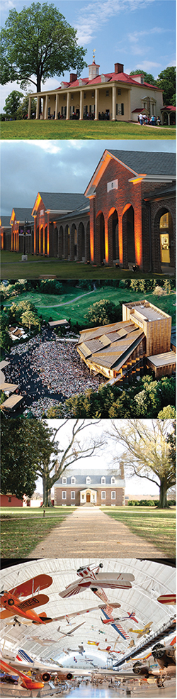
George Washington’s Mount Vernon Estate: This Neoclassical Georgian-style estate was the home of George Washington, our nation’s first president. It was also one of the first National Landmarks ever designated.
Directions by Bike: Ride to Mount Vernon on the scenic Mount Vernon Trail. From the west, the estate is accessible via the Mount Vernon Memorial Highway Trail. Bike parking is provided near the entrance and on the parking lot. Located in grid square Q16.


Workhouse Arts Center at Lorton: This world-class center for the arts features more than 65 artists in their studios. View their work, participate in classes, attend festivals and performances, tour the grounds while learning the history and purchase one-of-a-kind gifts.
Directions by Bike: The Arts Center is located along the Cross County Trail and also can be accessed via the Ox Road Trail. Bike parking facilities are provided. Located in grid square K16.


Wolf Trap National Park for the Performing Arts: The country’s only National Park for the performing arts includes casual and pavilion-style outdoor performance spaces. Highlights include the majestic Filene Center, the Children’s Theatre-in-the-Woods, Wolf Trap Opera Company and The Barns at Wolf Trap.
Directions by Bike: Access Wolf Trap from the Washington & Old Dominion (W&OD) via the Clarks Crossing or Meadowlark Road Trail that connect to the Trap Road Trail via the Beulah Road Trail. Bike parking is available. Located in grid square J6.


Gunston Hall: An 18th-century, Georgian-style mansion, Gunston Hall was the home of George Mason, the author of Virginia’s Declaration of Rights.
Directions by Bike: Follow the trail from the Pohick Bay Regional Park entrance south along Gunston Road to Gunston Hall (there is a trail connection to the campground). From Mason Neck State Park, follow the trail along High Point Road and Gunston Road north. Located in grid square N18.


National Air and Space Museum Steven F. Udvar-Hazy Center: This Smithsonian museum houses more than 300 aircraft and spacecraft, including the Space Shuttle Discovery and the SR-71 Blackbird.
Directions by Bike: Confident bicyclists can reach the Udvar-Hazy Center via the Air and Space Museum Parkway, which is a wide road with very little traffic. Please note that there are no dedicated bicycle or pedestrian facilities. Bike racks are available in front of the museum. Located in grid square D7.
 

Finished with your ride and looking for a place to park your bike? Check out this interactive map of bike racks in Fairfax County.

Fairfax Virtual Assistant