

Land Development Services Alert:
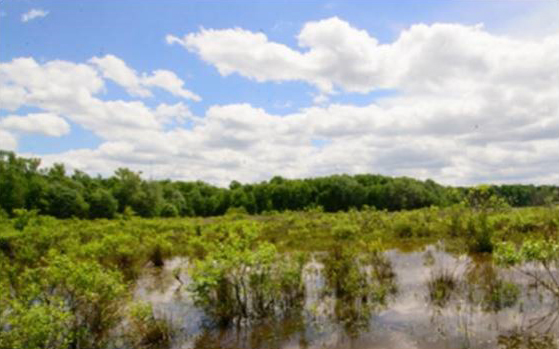
Reminder - effective July 1, 2024, the countywide Stormwater Pro Rata Share Assessment rate changed from $26,713.59 to $27,342.66 per increase in impervious acre; the maximum water quality credit increased from 61.7% to 61.9%; and the maximum water quantity credit decreased from 38.3% to 38.1%.
These revenues, collected during the development process and combined countywide, pay for the drainage infrastructure that is required to reduce harm to receiving waters in Fairfax County, the Potomac River, and the Chesapeake Bay. They also stop the deterioration of the current drainage systems and flood damage.
The county determines the Pro Rata Share assessment for an individual development project as a proportion of the total estimated cost of the drainage improvement program. The assessment is based on the stormwater impact of the project measured by its increase in impervious cover discounted by any applicable credit for on-site stormwater management facilities and best management practices provided as part of the new construction.
Once collected, the assessment fees will be allocated to the Fairfax County Department of Public Works and Environmental Services for the program. Learn more about typical community improvement projects supported by funding from the Pro Rata Assessment fee and other funding sources by visiting the Stormwater Management page.
For more information on Pro Rata Share Assessment, refer to Public Facilities Manual (PFM) § 6-0600.
If you have any questions, please contact the Site Application Center at 703‑222-0801, TTY 711.
![]()
County staff continue to implement additional improvements to the Planning and Land Use System (PLUS) to serve you better. Check out these new PLUS fixes for Land Development Services (LDS) customers.
PLUS Enhancement |
LDS Customer Benefit |
Updates to Building |
|
|
LDS FY2025 Fee Updates |
Updated permitting fees to align with the July 1, 2024, fee increase adopted by the Board of Supervisors. |
|
New Air/Duct Leakage Test Amendment |
Customers can now submit their air/duct leakage reports through PLUS under this new “Air/Duct Leakage Test” amendment type, under the associated residential building permit (BLDR) record. This enhancement replaces the previous Nintex form submission. For more information, visit the Air/Duct Leakage Test Amendment permit library guide. |
|
On-Site Contact Required on Commercial Building Records |
An on-site contact is now required as part of the initial application process when creating a building record in PLUS for all commercial projects. |
|
Updated Commercial and Residential Plumbing Equipment |
The equipment lists for residential and commercial plumbing records were updated to allow customers to select either Backflow Preventer – Testable Assembly or Backflow Preventer – Non-Testable Device. This allows applicants to better identify the type of device being installed and in turn, ensure staff determine whether it needs to be part of the annual inspection process. |
|
Accessory Living Unit (ALU) or Accessory Dwelling Unit (ADU) Question on Residential Building Records |
On Residential New, Residential Addition/Alteration and Residential Miscellaneous building records, a new yes/no question was added so an applicant can identify whether their application includes a proposed Accessory Living Unit (ALU) or Accessory Dwelling Unit (ADU). This also ensures intake staff are aware of any proposed ALU or ADU and can coordinate with appropriate review agencies at the time of submission and identify any deficiencies earlier on in the process. |
|
Elevator Updates |
Various elevator updates were performed to include the “Red Tag” status which is set by staff and visible to the applicant via PLUS, updating the FFXID when ownership changes and updates to the Vertical Transportation Inspection report. |
Update to Site |
|
|
LDS FY2025 Fee Updates |
Updated permitting fees to align with the July 1, 2024, fee increase adopted by the Board of Supervisors. |
|
FY2025 Pro Rata Share Assessment Rate Increase |
Effective July 1, the countywide Stormwater Pro Rata Share Assessment rate increase went into effect requiring updates to the corresponding rates in PLUS. The assessment is based on the stormwater impact of individual development projects and is measured by their increase in impervious cover, discounted by any applicable credit for on-site stormwater management facilities and best management practices provided as part of the new construction. All site records with unpaid Pro Rata share fees were updated to 2024 rates on July 1, 2024. |
|
Signature Set Review Cycle |
Signature Set submissions for site-related plans will now carry a base and per-sheet fee for submissions over 5 sheets. Signature Set submissions modifying 5 or less plan sheets, will not be assessed a separate fee. For more information, see our Fee Schedule. |
|
Updates to the RPA Minor Addition Walk Through Waiver |
The WAIV application for minor residential additions has been updated to streamline the submission process with better prompts, automation and help text while also eliminating the need to upload the PDF application with duplicative information. For details on the submission process, visit the WAIV permit library guide. |
|
Updates to the Hazardous Tree Program |
The Hazardous Tree inspection type and related checklist is now available for staff to use for better reporting and tracking of any hazardous tree complaints reported via the PLUS enforcement tab. For more information on when and how to report, click here. |
![]() We welcome your feedback on future PLUS enhancements. If you have ideas to improve the system, please take a moment to enter them here: LDS Customer PLUS Feedback Form.
We welcome your feedback on future PLUS enhancements. If you have ideas to improve the system, please take a moment to enter them here: LDS Customer PLUS Feedback Form.
![]()
 The Expedited Building Plan Review (EBPR) program, which has been available at Fairfax County’s Land Development Services (LDS) for over 20 years, is one of several methods provided to expedite review of permits for construction projects using certified and approved peer reviewers. EBPR is open to plans for any project size, construction type or use group without pre-approval by the Building Official.
Plans that go through the EBPR program have review timelines seven times shorter than non-EBPR plans. This significant reduction in review time is possible because EBPR plans have been reviewed by peer reviewers, resulting in better quality plans than non-EBPR plans. A majority of peer reviewed plans received at LDS are Commercial Interior Alteration (ALTC) plans. All plans, including these high-volume commercial interior alteration plans, are eligible for the expedited building plan review program.
Leveraging the expedited building plan review program could save your project time and money. If you are interested in participating in the EBPR program, contact Ali Heidari Goodarzi at 703-324-1087.
![]()
 Land Development Services (LDS) staff are continuously developing resources to help improve customer access to our services. To better serve our customers navigating the Planning and Land Use System (PLUS), a new guide is available to explain how to print a payment receipt in PLUS. Click here for the full guide on “How to Print a Payment Receipt in PLUS.
![]()
 In our ongoing effort to enhance the Planning and Land Use System (PLUS) and better serve our community, the Building Division is implementing an important change regarding the submission of Special Inspection documents. Effective Monday, July 15th, the county will no longer accept Special Inspection documents through email correspondence. Instead, all Special Inspection documents must be uploaded to the associated Critical Structures (CRIT) record in PLUS.
Key points to note:
For more details on this process, please visit our Critical Structures Permit Library. We appreciate your cooperation and support as we work to improve our systems and services. For more information about critical structures, contact Haval Barzingy at 703-324-1921, TTY 711 or Benjamin Sadeqian at 703-324-8465, TTY 711.
![]()
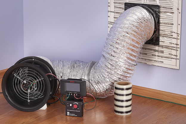 Thanks to a recent Planning and Land Use System (PLUS) enhancement, customers can now submit their air/duct leakage test reports through PLUS under the new “Air/Duct Leakage Test” amendment type under their original residential building permit (BLDR) record.
For more information about the Air/Duct Leakage Test, visit the Land Development Services Permit Library for a guide on how to apply for this amendment type and how to submit the test report.
The Air/Duct Leakage Test Amendment will be available in PLUS starting Thursday, July 12.
![]() For any returned payments, regardless of the reason (e.g., insufficient funds, unauthorized user), a stop work hold will be placed on your account. For returned payments, LDS requires a certified check for payment – no online payments via PLUS will be accepted until the account is brought back to good standing. The stop work hold will remain on your account until payment is received, preventing you from scheduling any inspections. To communicate in a timely manner, users will now receive an automated email notification if a payment is returned. If they have questions about why a payment was returned, they can follow up with their bank or contact LDS Finance at 703-324-1515, TTY 711.
For any returned payments, regardless of the reason (e.g., insufficient funds, unauthorized user), a stop work hold will be placed on your account. For returned payments, LDS requires a certified check for payment – no online payments via PLUS will be accepted until the account is brought back to good standing. The stop work hold will remain on your account until payment is received, preventing you from scheduling any inspections. To communicate in a timely manner, users will now receive an automated email notification if a payment is returned. If they have questions about why a payment was returned, they can follow up with their bank or contact LDS Finance at 703-324-1515, TTY 711.

![]() County staff continue to implement additional improvements to the Planning and Land Use System (PLUS) to serve you better. Check out these new PLUS fixes for Land Development Services (LDS) customers.
County staff continue to implement additional improvements to the Planning and Land Use System (PLUS) to serve you better. Check out these new PLUS fixes for Land Development Services (LDS) customers.
|
|
|
|
|
|
|
Update contacts on critical structures records. |
Customers can now create an amendment to update/add contacts on the Critical Structures (CRIT) record. |
|
Submit a revision to critical structures records. |
Customers can now submit a revision to the Critical Structures (CRIT) record allowing the applicant to update pertinent information on the form if something were to change out in the field. |
|
Update to elevator inspection report email. |
On the Elevator Inspection report, the click “here” link has been updated to allow for the report to be downloaded directly from the email notification. |
|
Notifications for unsuccessful payments. |
Applicants will now receive an email notification if an online payment is unsuccessful whether it be for insufficient funds or a returned check. Holds will be placed on records where the payment is unsuccessful and removed upon receipt of payment. |
|
|
|
|
Create batch report to move plats from Administrative Hold to In Review.
|
A daily report has been created to move Record Plats that are on Administrative Hold to In Review status when all fees are paid and conditions are met. This automated feature increases efficiency for both staff and customers, ensuring plats are quickly and effectively moved to Final Signature review and approval. |
|
Update comment fields on bonding-general conditions. |
This enhancement brings bonding conditions and related comments up to date with current processes bringing clarification for staff and customers. |
|
Update review distribution task for all site records when set to 'Waiting for Corrections'. |
Allows the Review Distribution task to function similarly to the Application Submittal task so that staff can request additional information when needed at resubmission prescreen on all site records. |
|
Staff can now add pictures to inspection reports in PLUS. |
This enhancement allows site inspection staff to automatically upload pictures to corresponding inspection reports while in the field, preventing delays in inspection reporting and adding efficiency to the overall inspection process. |
![]() We welcome your feedback on future PLUS enhancements. If you have ideas to improve the system, please take a moment to enter them here: LDS Customer PLUS Feedback Form.
We welcome your feedback on future PLUS enhancements. If you have ideas to improve the system, please take a moment to enter them here: LDS Customer PLUS Feedback Form.
![]() County staff continue to implement additional improvements to the Planning and Land Use System (PLUS) to serve you better. Check out these new PLUS fixes for Land Development Services (LDS) customers.
County staff continue to implement additional improvements to the Planning and Land Use System (PLUS) to serve you better. Check out these new PLUS fixes for Land Development Services (LDS) customers.
PLUS Enhancement |
LDS Customer Benefit |
Updates to Building |
|
|
Allow Revisions to Critical Structures Record |
Applicants can now submit a revision to their Critical Structures record (CRIT) to update contacts or make edits to the previously approved special inspections items. |
|
Upload Documents to Critical Structures Record |
Applicants can now upload documents to their Critical Structures record (CRIT). |
|
Add Helpful Web Links
|
Helpful weblinks were added to the building search page to provide customers with relevant resources including the LDS Permit Library and When a Permit is Required webpages. |
|
Add Solar Data Fields for Commercial and Residential Records
|
The Commercial and Residential Solar application has been updated with additional information required under Solar Installation Details. These data fields will be used to create reports to support and inform the county’s Community-Wide Energy and Climate Action Plan (CECAP). |
|
Add Pedestrian Bridges Work Type
|
A new type of work has been added under the Commercial Miscellaneous record for Pedestrian Bridges. This was added to better track, review and assess fees for this type of work. |
Updates to Site |
|
|
Update Financial/Invoice Report |
Allows site staff to view additional payment details and download a report for the customer. |
|
Allow Pictures to be Added to Erosion and Sediment Control Inspection Report |
Allows inspectors to attach photos directly to inspection reports in the field. This improvement significantly increases efficiency for site inspections. |
|
Update Entrance Correct Stamp and Process |
The Entrance Correct Stamp has been updated and the associated stamping process has been simplified. This change allows staff to efficiently provide needed documentation for customers to obtain their Virginia Department of Transportation (VDOT) permits for major plans. |
|
Update Virginia Pollution Discharge Elimination System (VPDES) Condition of Approval |
Additional clarification and instructions have been added to the existing VPDES permit condition to guide customers on how to submit their VPDES applications. |
![]() We welcome your feedback on future PLUS enhancements. If you have ideas to improve the system, please take a moment to enter them here: LDS Customer PLUS Feedback Form.
We welcome your feedback on future PLUS enhancements. If you have ideas to improve the system, please take a moment to enter them here: LDS Customer PLUS Feedback Form.
The General VPDES* Permit for Discharges of Stormwater from Construction Activities, also known as the Construction General Permit (CGP), will expire June 30, 2024. Per the permit regulations, any operator who was authorized to discharge under the expiring general permit and who intends to continue coverage (i.e., continue land-disturbing activities after June 30, 2024) must submit a new registration statement at least 60-days before the expiration date. Registration statements are submitted via email.
A complete and accurate registration statement should be submitted to Land Development Services no later than May 1, 2024. If final stabilization has been achieved, please submit a Notice of Termination.
For all VPDES-related applications, including the new 2024 Registration Statement, Notice of Termination, and Transfer Agreement, visit our Forms and Publications Library.
For a list of active 2019 Construction General Permits, visit DEQ’s Stormwater-Construction page.
For questions or additional information, contact the Site Services branch at 703-222-0801, TTY 711.
*VPDES is an acronym for the Virginia Pollutant Discharge Elimination System.