

Transportation Alert:
 The Fairfax County Department of Transportation (FCDOT) is conducting a study on the Route 29 corridor, between Buckleys Gate Drive/Summit Drive near the Fairfax County Parkway (VA 286) and Jermantown Road. The purpose of this study is to reassess the long-term needs of the corridor and develop solutions that serve residents and commuters, while moving away from the interchanges that are identified in the current Fairfax County Comprehensive Transportation Plan (CTP).
The Study will assess options for maintaining future safety, mobility and accessibility for both non-motorized and motorized transportation users, while taking into consideration impacts on development, the environment and cost to taxpayers. The study also will explore the multimodal potential of the Route 29 corridor, such as possible bike and pedestrian facilities.
This study and its recommendations will be coordinated with the ongoing Fairfax Center Area Comprehensive Plan Amendment, where land use and transportation needs for the core of the suburban center are being reassessed, and the Active Fairfax planning effort, where the County is assessing plans countywide for bicyclists and pedestrians.
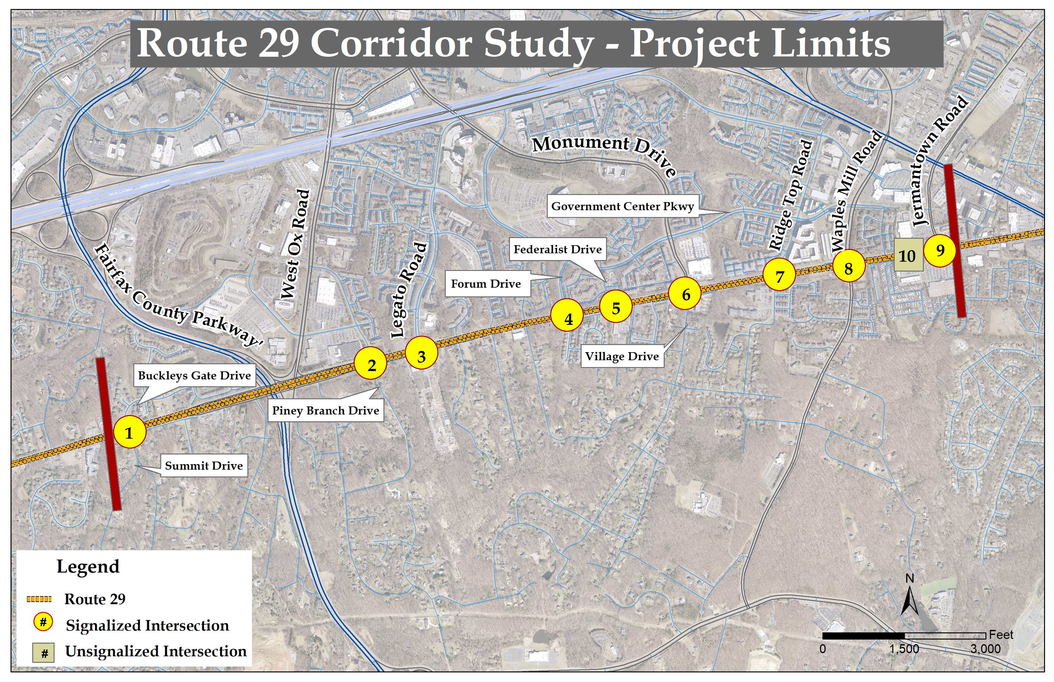
The Route 29 study corridor, as shown in the Figure, spans approximately 2.9 miles between the intersection of Buckley’s Gate Drive/Summit Drive to the intersection of Jermantown Road at the city of Fairfax line. The study corridor predominantly serves residential land uses, along with public facilities, retail, commercial and office uses.
This segment of Route 29 is a six-lane divided roadway that includes the following:
Only WMATA’s Metrobus Route 1C runs along Route 29 corridor between Ridge Top Road and Jermantown Road.
The study began in March 2023 and was completed in Fall 2025.