Public Works and Environmental Services

CONTACT INFORMATION: Our administrative offices are open 8 a.m. – 4:30 p.m., Mon - Fri
703-324-5500 TTY 711
12000 Government Center Parkway
Suite 449, Fairfax, Va 22035
Shannon Curtis
Chief, Watershed Assessment Branch

Belle Haven, Dogue Creek and Four Mile Run Watersheds

map of watershed areaLocation
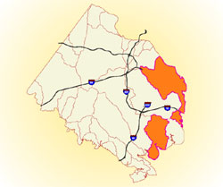
The Belle Haven, Dogue Creek and Four Mile Run watersheds (2.8 square miles, 19.4 square miles and 30.1 square miles, respectively) are located in the southeastern portion of Fairfax County and drain directly to the Potomac River. The Belle Haven watershed goes through Dyke Marsh before reaching the Potomac River, the source of drinking water for many residents.

Major Streams and Tributaries
Dogue Creek: Major tributaries include Barnyard Run, North Fork and Piney Run.

Belle Haven: The major tributary is Hunting Creek.

Four Mile Run: The major tributary inside of Fairfax County is Four Mile Run lower mainstem

Unique Features
This watershed group includes a portion of Fort Belvoir, the U.S. Coast Guard Reservation and Huntley Meadows Park. The majority of Four Mile Run lies within Arlington County or the City of Alexandria, which are outside the jurisdiction of Fairfax County.

Improvement Opportunities
The plans identify areas of opportunity for implementing both structural and non-structural improvement projects such as stream restorations, stormwater facility retrofits, community education and stewardship, streamside buffer enhancements and installation of green stormwater infrastructure (GSI). Proposed projects in the plans have recommended priorities. These lists should not be interpreted as specific implementation schedules or a guarantee that the project will be implemented through the planned Capital Improvement Program (CIP). A full list of active or completed Stormwater projects is available online on at Stormwater Improvement Projects or through Jade (Fairfax County's Comprehensive Mapping Application).

Fairfax Virtual Assistant