Resource Protection Areas (RPAs) are regulated corridors of environmentally sensitive land that lie alongside or near the shorelines of streams, rivers and other waterways. In their natural condition, RPAs protect water quality, filter pollutants out of stormwater runoff, reduce the volume of stormwater runoff, prevent erosion and perform other important biological and ecological functions. RPAs help safeguard the quality of our local rivers and streams and contribute to the health of the Chesapeake Bay.
RPAs were established under the county’s Chesapeake Bay Preservation Ordinance and are typically identified as 1993 RPAs or 2003 RPAs, depending on the time the ordinance provisions first required their establishment. Generally, RPAs are areas which should remain in a natural, undisturbed condition. If encroachment is necessary, the county is required to ensure that any encroachment is minimized, and steps are taken to reduce the impacts of the encroachment on water quality and appropriate mitigation is provided.
The removal of dead, diseased, dying and/or invasive, non-native vegetation is permitted within an RPA, with county approval. To request approval, submit an RPA waiver (WAIV RPA) via our online permitting system known as PLUS.
How to Submit in PLUS
- Obtain a House Location Plat or Site Exhibit and draw/label the location, type and number of vegetation requiring removal.
- To obtain a plat, please visit zoning’s Submitting House Location Plats page.
- To obtain a Site Exhibit using the county’s Watershed and RPA map viewer, visit Watersheds & Resource Protection Areas Viewer (arcgis.com) and enter your property information in the top left corner of the application.
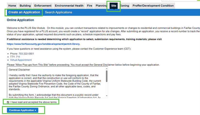
- Apply for your RPA waiver online in PLUS under the Site tab. If you are a first-time user, you must first register for an account.
- Click on the “Site” Module Tab
- Click “Create an Application”
- Check the “I have read and accepted the above terms”
- Click “Continue Application”
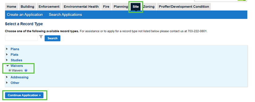
- Click “Waivers”
- Click “Continue Application”
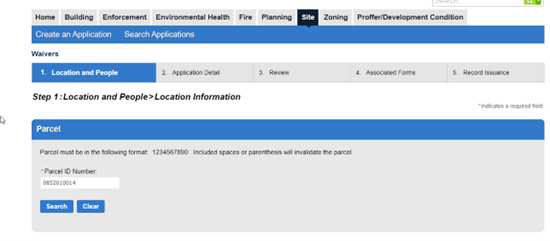
- Complete the ‘Location and People’ Tab
- Enter the Parcel ID Number (Tax Map number from iCare). Do not include spaces, parenthesis nor hyphens. If the number does not work as listed, try entering most of the number and “searching” for the full, valid parcel ID.
- Continue the application as prompted. Enter any additional contact information, as desired on the associated record (contractor, design professional, or applicant if other than property owner).
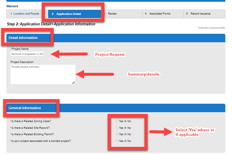
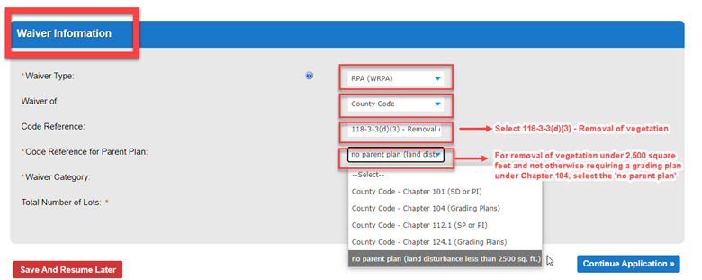
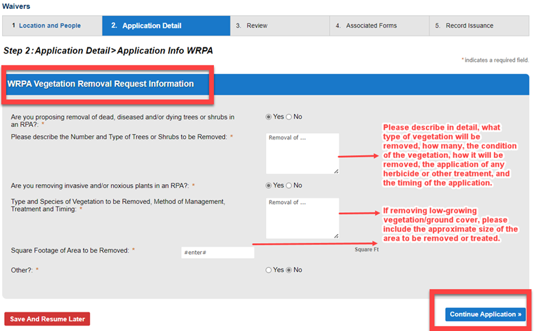
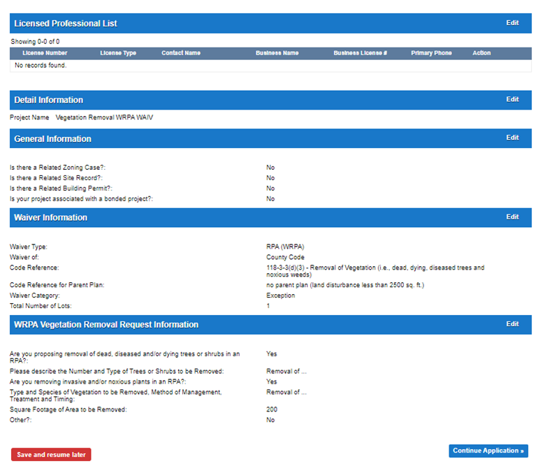
- Complete the ‘Application Detail’ tab
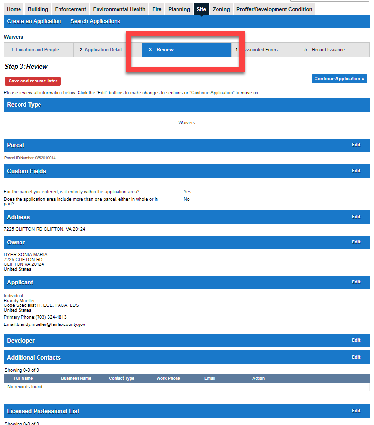
- Review your application. Edit any details, as necessary and either save and resume later or continue to advance your application.
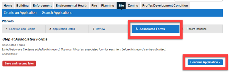
- For Step 4: Associated Forms – there are no additional forms required for this application type. Please ‘continue application’.
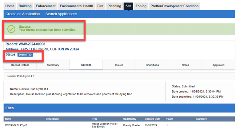
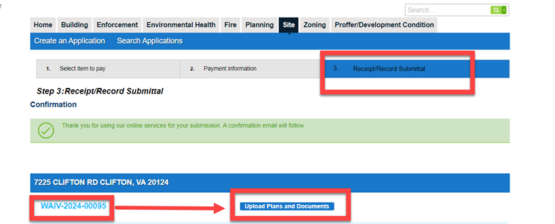
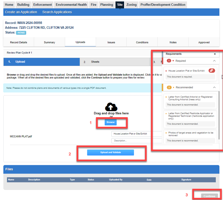
- At the next screen you will receive confirmation of your WAIV record number and a link to upload required documents. Please click the upload link to upload your house location plat or site exhibit document, any photographs and/or third-party professional reports (i.e., certified arborist report). A separate email will follow, confirming the need to upload to complete your submission.
- Once you complete the upload of required documents, you will receive final confirmation of your successful submission.