

Franconia Triangle (S-9 Beulah Community Planning Sector Recommendation Area #3) Study
2016 Proffer Reform Bill - Non-Exempt Area
Adopted On:
May 13, 2025
PLUS Record Number:
PA-2023-00006
Supervisor District:
Franconia
Planning District:
Springfield
On April 11, 2023, the Board of Supervisors authorized the Franconia Triangle Study to evaluate and update Plan recommendation #3 of the S-9 Beulah Community Planning Sector, including but not limited to specific considerations for the proposed land use mix and density/intensity proposed for land areas within the study area accepted into the 2022-2023 Countywide Site Specific Plan Amendment (SSPA) process. A nomination (CPN22-LE-003, referred to as “Beulah Street SSPA”) to redevelop and repurpose two office buildings for single-family detached and multifamily residential uses was submitted via the SSPA process. Additionally, the proposed redevelopment of the Franconia Governmental Center with affordable multifamily residential use was included in the planning study area.
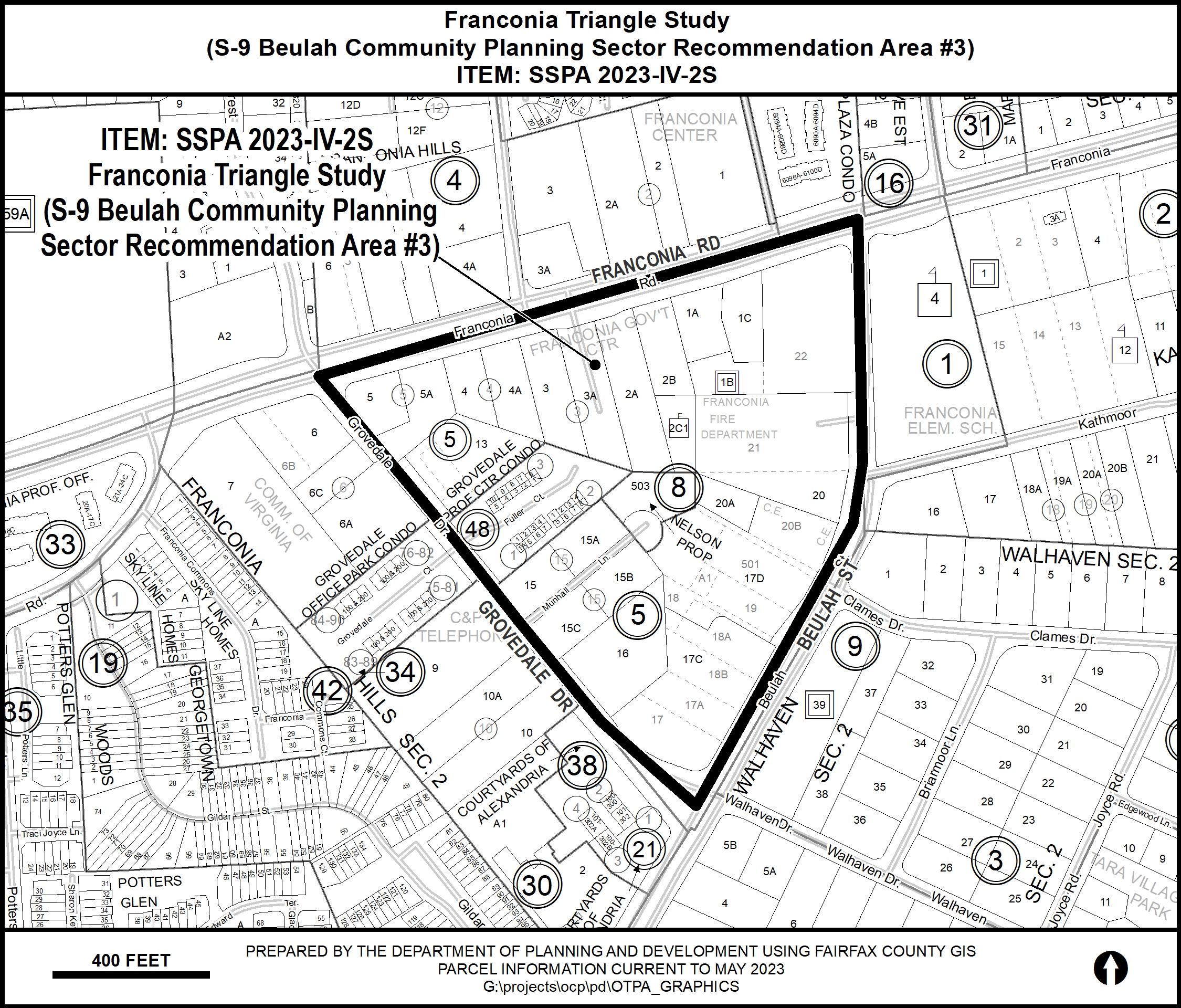
Plan Amendment SSPA 2023-IV-2S concerns approximately 22.75 acres of land bounded by Franconia Road, Beulah Street and Grovedale Drive in the Franconia Supervisor District. The area is planned for public facility, governmental and institutional use, office use, and retail use up to 0.25 FAR. The amendment will consider:
- Retail use up to 0.30 FAR along Franconia Road and for Tax Map Parcel 81-3((5))13;
- Multi-family residential use up to 120 units for the Franconia Governmental Center (Tax Map Parcels 81-3 ((5)) 3A, 2A, 2B, 2C1 and 83-3 ((8)) 503);
- Multi-family and attached residential use up to 12 dwelling units per acre for the Beulah Street SSPA site (Tax Map Parcels 81-3 ((5)) 15, 15A, 15B, 15C, 17C and 17D);
- Attached residential use on Tax Map Parcel 81-3 ((5)) 16 subject to consolidation or coordination of development with the adjacent residentially planned parcels.
Click on the map (above) for a detailed enlargement of the area.
Related Resources
Staff Report (Download)