

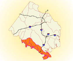
 Location
The Lower Occoquan watersheds group lies along the southern border of Fairfax County and consists of eight small watersheds which drain either to the Bull Run/Occoquan River system or directly to the Potomac River. These are Old Mill Branch, Wolf Run, Ryans Dam, Sandy Run, Occoquan Creek, Mill Branch, Kane Creek and High Point. The eight watersheds span 45.4 square miles.
Major Streams and Tributaries
Small tributaries within these watersheds include Maple Branch, Stillwell Run, Elk Horn Run, Giles Run, South Branch and Massey Creek.
Unique Features
Approximately half of the Lower Occoquan watersheds area is overlain by the Watershed Protection Overlay District. This zoning district was established in 1982 by Fairfax County in a progressive move to protect the Occoquan Reservoir, a major source of drinking water for the county. This designation restricts development to one residential dwelling unit per five acres, thereby protecting the streams draining to the reservoir from the damaging impacts of more intense land development – primarily nutrient and sediment pollution.
As a result, this portion of the Lower Occoquan watersheds is densely wooded in most areas and contains some of the highest quality streams found in the county. The Laurel Hill property (formerly the Washington, D.C. Department of Corrections/Lorton Prison facility) is almost completely included in the Lower Occoquan watersheds and is comprised mostly of parkland and open space areas. Historic Gunston Hall, the site of George Mason’s Plantation, is located in the southeastern-most portion of the Lower Occoquan watersheds area in the Mason Neck area. This peninsula on the Potomac contains Mason Neck State Park and the Mason Neck National Wildlife Refuge and is bordered on three sides by Belmont Bay, Occoquan Bay, Gunston Cove and the Potomac River.