

Beulah Community Planning Sector, Land Units A, B and C
Adopted On:
October 24, 2017
Tax Map Parcels:
91-1((1))11A, 11B2, 23F; ((4))ALL;((28))1A, 2B; ((31))1A, 1B, 2A, 2B, 2C, 3, 3A, 3B, 4A, 4B1, 4C2; ((32)) ALL
Supervisor District:
Franconia
Planning District:
Springfield
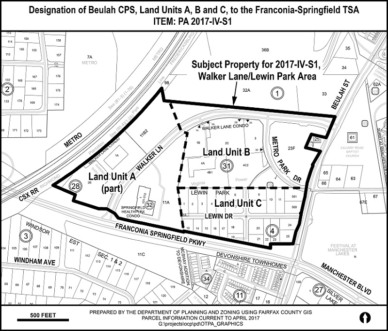
This Comprehensive Plan amendment designated Beulah Community Planning Sector's, Land Units A, B and C, excluding Land Unit A, parcel 91-1((1))11C, to the Franconia-Springfield Transit Station Area. The approximately 58 acre area is located in the northwest quadrant of the intersection of the Franconia-Springfield Parkway and Beulah Street in the Springfield Planning District, Franconia Supervisor District.
The adopted Plan for this area recommends alternative uses for Land Units A and B, and residential uses at a density of 1-2 du/ac for Land Unit C. No changes to land use recommendations or density were considered for this Plan amendment.
Click on the map (above) for a detailed enlargement of the area.